
Park It! (Part Two)
There are four national parks on New Providence, the island where Nassau is located, although I'd stretch that to five, if you count Clifton, where I went snorkelling twice and saw the undersea sculptures. I set myself the goal of getting to all of them, aided by my sister-in-law, who not only had a car but is also an avid birder.
When we were at The Retreat (as mentioned here, I asked the girl behind the desk for details about two other parks I had seen on their website: Bonefish Pond and Harrold and Wilson Ponds. We weren't given much information about the former, and in the latter, we were told that it was closed, but no reason was given.
Not surprisingly, that encouraged me to do a little digging and find out how to access them: I enjoy challenges like that and the fact that we had driven close to both but had seen no signage for them only made it more fun.
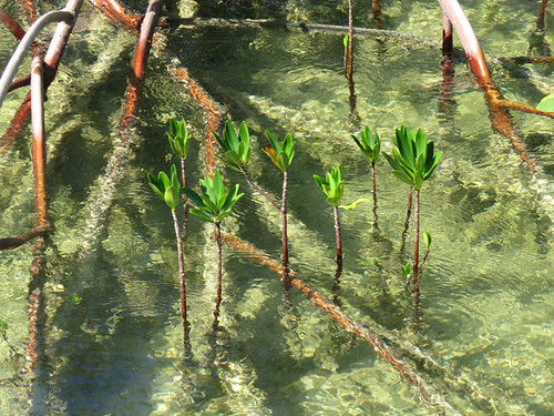
Bonefish Ponds was an amazing place: a brand-new paved road leads to a small parking lot in the northwest corner of the park, and then onto the boardwalk out to the observation deck.
Above a 360˚ panorama I shot, looking back at the parking lot from the boardwalk: click on the tiny thumbnail to see it in all its glory. The tide was running out when we got there, and we were able to see the red mangrove shoots up close and personal as the level of the water dropped.
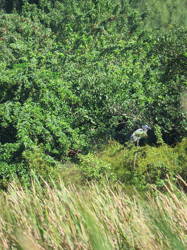
There's another access point to the south-east corner which we visited a couple of days later, although there wasn't all that much to see: the highlight of going out there, however, was the flock of glossy ibis we saw on the way. Wish I could have gotten my camera out faster!
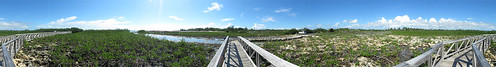
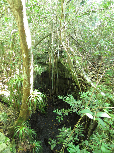
And then there was the challenge of Harrold and Wilson Ponds: I explored the BNT's map to find the boardwalks at the northeast and southwest corners, and then we drove out. Lots of herons and egrets, but it's easy to see why the southwest part of the park has portions of the boardwalk closed: the invasive cattails are as tall as I am!
![]()
Once again, a small, simple photograph doesn't do this place justice, so we found the hilltop overlook on the map at the other two areas a couple of days later, and I shot this panorama (above) of the area.
Something that continually surprised me on these expeditions was the excellent quality of the maps at the individual parks, but apart from finding Primeval Forest, the last of the parks on the list, there was virtually no signage on how to get to them. Had it not been for Google Maps, where I plotted out all the waypoints before importing them into my trusty Garmin eTrex 20 GPS, most of these adventures would have been a lot more complex.
The biggest reason why Primeval Forest exists is because the landscape is mostly karst, which made it virtually impossible to be developed in any way. You drive down a small backroad to the large BNT sign, park, and follow the wonderful route that's been laid out. Great signage, even a circular staircase that takes you inside one of the deeper features, and even though you're not that far from the airport, you feel transported back in time.
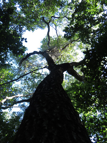
Ironically, after I took the picture of what is considered the oldest tree on the island, this mahogany (below), we visited the ranger in his little cabin to sign the guestbook and buy a shirt to support the BNT: the photograph on the back of the shirt is identical to the one I took.


No comments:
Post a Comment